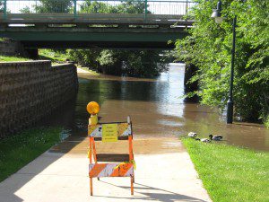
Upcoming flooding next week will impact area trails.
The National Weather Service is predicting the Cedar River at Cedar Rapids to reach a flood stage of 14.7 feet on Tuesday, June 24th. Flooding will impact the Cedar River Trail near the 8th Ave. Bridge, at the CRANDIC Railroad Bridge underpass, and south of Sokol Park as early as Sunday, June 22nd. In addition, high water may restrict trail usage of the Sac and Fox Trail, between the Indian Creek Nature Center and Cole St., and the Prairie Park Fishery Trail. In the past, river stages above 11 feet limit the usage of trails located near Cedar River. For your safety, please use caution and remember the following:
- Avoid riding or walking through water that covers an entire section of trail.
- When sections of trail are closed due to flooding, obey all barricades and signage. Refrain from moving and/or going around barricades.
- Slow down when standing water, mud and/or debris are found on the trail.
- Linn County has several other trail opportunities to explore while these trail sections are closed.
Current river levels can be found at the National Weather Service’s Advanced Hydrologic Prediction Service website: http://water.weather.gov/ahps2/hydrograph.php?wfo=dvn&gage=cidi4. LCTA will provide updates of trail closures and openings during the next week.

